The chief objective of the Jason programme initiated by CNES and NASA is to measure sea-surface height and surface wind speed in real time, in order to monitor and forecast ocean variations.
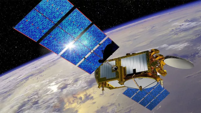
Jason-3 is the third in the French-U.S. series of Jason satellites, providing continuity of ocean level data from its orbital vantage point 1,336 km above Earth.
Key information
| Mission | Measure ocean surface topography, surface wind speed and average wave height |
|---|---|
| Domain | Earth observation |
| Launch date | 17 January 2016 |
| Partners | NASA, Eumetsat, NOAA, OCA, Thales Alenia Space (Jason 1-2) |
| Where | Non-sun-synchronous orbit (inclined 66°) at an altitude of 1,336 km |
| Lifetime | 5 years |
| Status | In operation |
Key figures
- 95% of the world’s ice-free oceans overflown every 10 days by Jason-3
- 7 to 8 instruments on each satellite
- ~500 kg: mass of each satellite
- 3.3 cm: accuracy of Jason-3 sea-surface height measurements
Key milestones
- 10 October 2019: End of Jason-2 mission
- 17 January 2016: Jason-3 launched by Falcon 9
- 1 July 2013: End of Jason-1 mission
- June 2013: Start of integration of Jason-3
- 12 April 2010: Jason-3 project go-ahead
- 20 June 2008: Jason-2 launched by Delta II
- January 2008: End of assembly and testing of Jason-2
- June 2007: Start of assembly and testing of Jason-2
- December 2005: Jason-2 preliminary project review
- 7 December 2001: Launch of Jason-1 by Delta II
- Autumn 1999: End of integration of Jason-1
- August 1998: Qualification of Proteus spacecraft bus
- December 1996: NASA/CNES partnership agreement
- September 1993: Jason project kick-off
Project in brief
The Jason family comprises three satellites—Jason-1, Jason-2 and Jason-3—launched in 2001, 2008 and 2016 to acquire data on ocean level, wave heights and wind speed in real time.
These data are processed by the SALP altimetry and precise positioning department at CNES, and then used to monitor the oceans in real time, generate marine meteorology bulletins and compile navigation charts for shipping. They also help climatologists to learn more about climate mechanisms, in which the oceans are known to play a major role.
This series of altimetry satellites initiated by TOPEX/Poseidon in 1992 has revealed that the global sea level is rising at an average rate of three millimetres a year. They have also helped scientists to better understand the vast system of deep and surface ocean currents. Today, they are a benchmark for other altimetry satellites like SARAL, CryoSat, HY-2A and SWOT and their operational applications are burgeoning.
Jason-3 ensures vital continuity of the ocean data record in the current context of global warming, while also developing operational services. Like its predecessors, it operates in a high-inclination 1,336-km orbit, covering 95% of the globe’s ice-free oceans every 10 days. Its instruments are mounted on a Proteus spacecraft bus supplied by CNES. In 2020 and 2026, two new Jason satellites—Jason-CS-A/Sentinel-6A and Jason-CS-B/Sentinel-6B—will join it in the same orbit.
CNES’s role
The Jason-3 programme is led by Eumetsat and NOAA as operational agencies. CNES provides a contribution in kind and is technical system coordinator. NASA, working with Eumetsat, NOAA and CNES, is supporting mission science teams.
CNES, which has oversight responsibility for the mission satellites and system, has been closely involved in developing the Jason satellites. The agency supplied the spacecraft bus, built by Thales Alenia Space.
CNES also developed the two instruments on the Jason satellites: the Poseidon altimeter and the DORIS receiver. CNES and NASA, the initiators of the Jason mission, have since been joined by two new partners, Eumetsat (European Organisation for the Exploitation of Meteorological Satellites) and NOAA (National Oceanic and Atmospheric Administration). The Jason science data user community collaborates through the Ocean Surface Topography Science Team (OSTST), an international grouping of 80 science teams in France and around the world.
Contacts
Project Leader
Christophe Marechal
E-mail: christophe.marechal at cnes.fr
Oceans subject matter expert
Yannice Faugère
E-mail: yannice.faugere at cnes.fr


