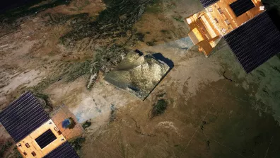
The four small satellites in the CO3D constellation (Constellation Optique en 3D) are set to map the globe in 3D from low Earth orbit starting in July 2025, to serve public and private sector needs.
Key information
| Mission | Earth observation and 3D mapping |
|---|---|
| Domain | Earth observation |
| Launch date | July 25, 2025 at 10:03 PM local time (July 26 at 2:03 AM UTC) |
| Partners | Airbus Defence & Space and IGN (Institut National de l'information Géographique et forestière) |
| Where | Low Earth polar Sun-synchronous orbit (SSO) at an altitude of 502 km |
| Lifetime | 6 years |
| Status | In operation |
Key figures
- 4 satellites in constellation
- Around 250 kg : mass of each satellite
- 50-cm spatial resolution images
- 3D products of 1-m relative altimetric accuracy
Key milestones
- Mid-2027 : End of demonstration phase and start of commercial phase
- Early 2026 : Start of demonstration phase
- July 2025 : Launch of constellation and start of in-orbit commissioning
- 9 December 2020 : CO3D launch contract awarded to Arianespace with Vega C
- 8 July 2019 : CNES selects Airbus Defence & Space to build satellites
Project in brief
To succeed the stereoimaging capability provided by the Pleiades satellites, CNES has conceived the CO3D programme to deliver geographic data covering the entire globe in three dimensions. By surveying the same area of interest from different viewing angles, it’s possible to generate 3D maps. Image acquisition by pairs of satellites also enables synchronous measurements to render moving objects (e.g. vehicles or waves), while having two pairs of satellites augments revisit capability and coverage of wide survey areas.
Each CO3D satellite will have a unique optical instrument with a spatial resolution of approximately 50 cm in the red, green and blue visible bands and in the near-infrared. After processing on the ground, their data will yield 3D maps of all of Earth’s land surfaces between -60° and +70° latitudes. These maps will be in the form of a digital surface model (DSM) with a relative altimetric resolution of approximately one meter on moderate slopes. DSM production will cover some 40 million square kilometres annually, a rate unrivalled anywhere in the world at such a high level of accuracy. DSMs will be used by the military and by civil society, as well as opening up new commercial prospects for start-ups and established firms alike. The entire globe is expected to be covered in five years and for certain categories of user—glaciologists, snow scientists, geologists, etc.—zones of interest will be remodelled every few months.
On 8 July 2019, CNES awarded the CO3D contract to Airbus Defence & Space, which is currently building the satellites around a new spacecraft bus weighing about 300 kilograms equipped with electric thrusters for in-orbit manoeuvres and a new generation of reaction wheels offering a high degree of agility. The instruments will use new optics to acquire imagery and offer the ability to pre-process it on board and then downlink it to ground at very high data rates.
CNES’s role
CNES established the CO3D programme and is responsible for the quality of imagery and 3D products. To this end, it is developing 2D and 3D product processing chains that will form part of the ground segment, as well as the Image Quality unit devoted to radiometric and geometric image calibration.
Contacts
Project Leader
Lionel Perret
E-mail: lionel.perret at cnes.fr
System Performance
Laurent Lebegue
E-mail: laurent.lebegue at cnes.fr
Continental Biosphere subject matter expert
Philippe Maisongrande
E-mail: philippe.maisongrande at cnes.fr
Water Cycle subject matter expert
Delphine Leroux
E-mail: delphine.leroux at cnes.fr