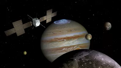
Among the data the spacecraft collected were several observations with the Moons And Jupiter Imaging Spectrometer (MAJIS).
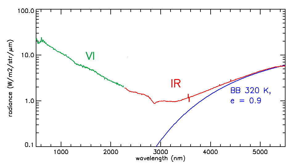
The MAJIS instrument is a mapping spectrometer working in the 0.5- 5.56 µm spectral range with 150 meters resolution from a distance of 1000 km, able to provide a spectrum with 1016 independent "colors" of a target. Part of these colors are in the visible range but most of them are in the infrared, a part of the spectral range which is invisible to the human eyes. The spectrum provides the capability to retrieve the composition and the physical properties of the observed target. All of this makes MAJIS perfectly suitable to produce detailed maps of the surface composition of the Galilean satellites and their exospheres, but also to identify the chemical-physical properties of Jupiter's atmosphere.
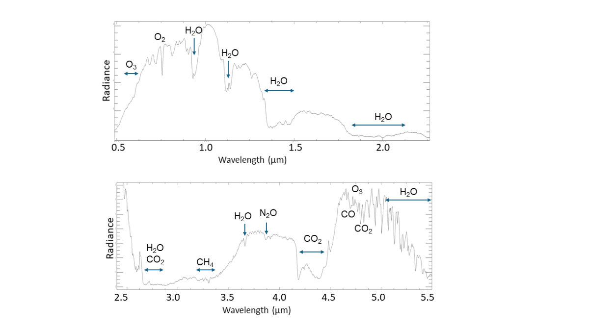
Each pixel of the images taken by MAJIS during the Earth flyby contains a spectrum rich in information about the composition of the Earth's atmosphere. This gives a foretaste of the instrument's performance in identifying the composition of Jupiter's atmospheric species.
Testing MAJIS performance
The Earth and the Moon observations performed during the JUICE flyby were the best opportunity during the cruise to test the performances and calibration of MAJIS with extended targets, similar in size to what we expect at Jupiter during the nominal mission. On the other hand, Moon and Earth are very bright objects that require the use of special observation modes to avoid the saturation of the detectors, another important flexibility of the MAJIS instrument.
The spectrometer and the two detectors are passively cooled down using thermal radiators while a sophisticated scan mirror placed at the entrance of the telescope can be used to scan the target or to compensate for the motion when the relative speed between MAJIS and the target is too high.
From calibration... to science!
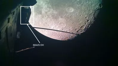
Lunar seas and highlands in the crosshairs
In addition to the calibration, the flyby observations own important science content. MAJIS provides local coverage of the lunar surface down to about 130 meters from the visible up to the thermal infrared range.
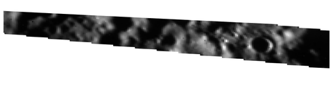
It was possible for example to confirm the radiometric performances of the instrument and to identify the thermal emission and the reflectance radiations due to seas or “maria” and lunar highlands.
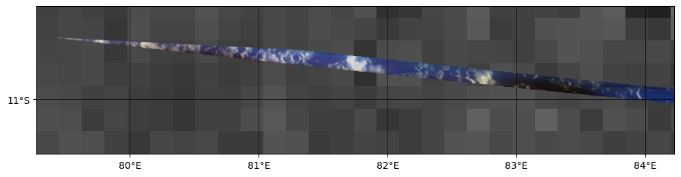
Earth as seen by MAJIS, from night side to day side
This Earth region acquired in this image was in full night and thus completely dark in a visible camera. MAJIS can detect light also in the thermal infrared, so that it is able to see what is otherwise invisible to a human eye. A combination of false colors is used in this image to enhance the different properties of the clouds in terms of composition and temperature.
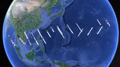
MAJIS observations of Earth, during the Earth flyby are composed of a set of image cubes acquired at km-scale spatial resolutions with spectral resolution down to 3.6 nm, and covering a range of different viewing and solar geometries (from nightside to dayside).
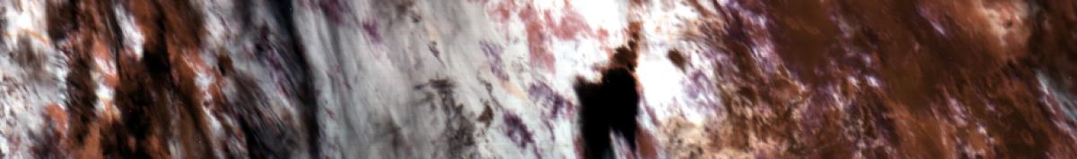
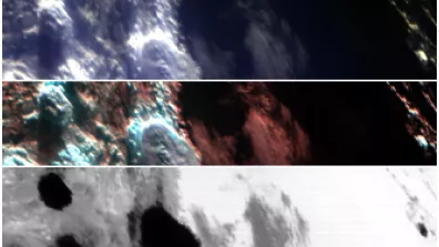
A set of masks have been developed to distinguish between different atmospheric composition captured by the MAJIS measurements of Earth using strong and consistent reflectance features specific to the individual topographies. MAJIS also measures thermal emission with spectacular view of the nightside.
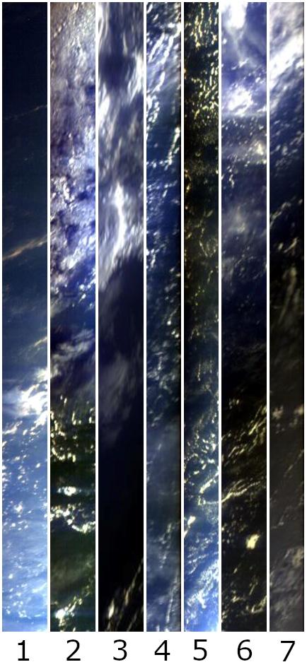
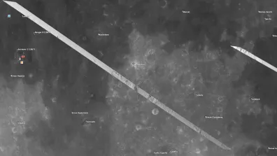
The first image (number 1) starts with the observation of the nightside and ends with the day on Earth, which corresponds to the terminator crossing. Variations in the color are due the presence of clouds and illumination conditions over the Pacific Ocean. The pixel size is between 1.3 and 1.5 km. Selected spatial windowing (a very useful capability of the instrument) has been applied on purpose on some images (number 4, 5 and 7) to track potential straylight signal in the out-of-field MAJIS pixels (dark columns).
On the image above, different wavelengths were selected to enhance the variability of the scene and composition. The image 3 is acquired in the thermal infrared wavelength which provides a temperatures map of the region. Dark spots correspond to lower temperatures.
MAJIS has been developed by a large consortium of European scientists and engineers, with two major contributions by France and Italy through the support of their respective space agencies, CNES and ASI. The main scientific contribution and responsibility are from IAS - Orsay - France and INAF - Italy.