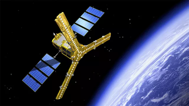
The European SMOS satellite (Soil Moisture and Ocean Salinity) was launched in 2009 to gain new insights into the key components of the water and carbon cycles on land and at sea.
Key information
| Mission | Measure soil moisture, plant water content and ocean salinity |
|---|---|
| Domain | Earth observation |
| Launch date | 2 November 2009 |
| Partners | ESA, CDTI |
| Where | 755-km Sun-synchronous circular orbit |
| Lifetime | Extended to 2026 (2028 envisioned) |
| Status | In operation |
Key figures
- 670 kg: satellite mass
- 21 cm observing wavelength (L band)
- <0.1 PSU (practical salinity unit) measurement precision for ocean salinity
- 4% measurement precision for soil moisture
Key milestones
- 2 November 2009: SMOS launched by Rockot
- 16 September 2009: Satellite shipped to Plesetsk launch site
- July 2007: Satellite testing gets underway
- June 2007: Flight model of payload delivered
- April 2007: Flight model of PROTEUS spacecraft bus delivered
- September 2005: Start of phase C of satellite development
- October 2004: Start of phase B of satellite development
- June 2004: Start of phase C/D of payload development
- November 2001: Start of phase B of payload development
- October 2000: Start of phase A of payload development
- April 1999: SMOS project selected by ESA
Project in brief
Launched on 2 November 2009, the SMOS mission is designed to map soil moisture and ocean salinity. Such data provide precious insights for meteorologists, hydrologists and climatologists. Monitoring ocean salinity enables them to detect the currents that strongly influence weather and climate patterns, and to better understand the role of oceans in the carbon cycle, while measuring soil moisture tells us about interactions between Earth’s surface, vegetation and the atmosphere, thereby increasing the accuracy of weather forecasts. Soil moisture data also allow us to better assess flood and drought risks, helping to manage water resources more efficiently. The SMOS satellite acquires all of these data with a radiometer that measures microwave radiation emitted from Earth’s surface at a frequency highly sensitive to water content.
CNES’s role
SMOS is the second Mission of Opportunity of the European Space Agency’s Earth Explorer programme. It is being led by ESA, CNES and CDTI, the Spanish government agency with responsibility for space.
CNES is involved in this mission on several counts. The SMOS Principal Investigator (PI) is a research scientist at the agency, which supplied the spacecraft bus and is in charge of data collection by the satellite. The agency also developed and is operating the SMOS satellite control centre at its Toulouse Space Centre, as well as the SMOS data centre (CATDS) in Plouzané, France.
Contacts
Development Project Leader
François Bermudo
E-mail: francois.bermudo at cnes.fr
Principal Investigator (PI)
Yann Kerr
E-mail: yann.kerr at cesbio.cnes.fr
Continental Biosphere subject matter expert
Philippe Maisongrande
E-mail: philippe.maisongrande at cnes.fr


