To know Earth better and make getting around easier, we need a way to find our bearings. That’s why being able to geolocate is vital for numerous studies in the field of geodesy, as well as in meteorology, environmental science, agriculture and many other domains. With a network of 40 GNSS stations around the globe, the REGINA project is tailored to the needs of the international scientific community.
Key information
| Mission | Provide CNES’s navigation and geodesy experts and the scientific community with comprehensive international geolocation data |
|---|---|
| Domain | Telecoms, navigation |
| Start date | REGINA agreement signed between CNES and IGN, the French national mapping, survey and forestry agency, in 2012 |
| Partners | IGN |
| Where | 40 GNSS stations around the globe, mission centres at CNES in Toulouse and IGN in Saint-Mandé |
| Lifetime | Indefinite |
| Status | In operation |
Key figures
- 40 GNSS stations
- 500+ receivers in permanent GNSS network
- 34 host organizations
Key milestones
- 2023: GEMOP Consortium (Galileo and EGNOS Monitoring Of Performances) gets underway
- 2020: Website goes live (https://regina.cnes.fr/)
- 2018: Deployment begins of receivers compatible with Galileo E6 band for commercial service
- 2012: CNES and IGN initiate REGINA project
- 28 December 2005: GIOVE-A Galileo precursor satellite launched
- 26 May 2003: Galileo project gets underway with European Union and ESA
Project in brief
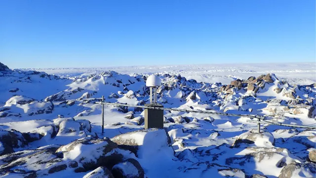
To understand and predict the movements of Earth’s crust, we need to know precisely the position of points on its surface. Analysing data at these different points yields precious information about the performance of navigation systems like the U.S. GPS, Russian Glonass, Chinese Beidou or Galileo, the European system soon set to complete its constellation. On the ground, hundreds of very-high-precision Global Navigation Satellite System (GNSS) stations receive these data and relay them to a range of infrastructures for processing and distribution for scientific, commercial and military purposes. With more than 500 receivers in its RGP permanent GNSS network in France, the French national mapping, survey and forestry agency IGN processes national data for mapping, teleguidance and other applications. The REGINA project (for REseau GNSS pour l’IGS et la NAvigation) operates a network of some 40 GNSS receivers around the globe.
This international coverage is one of the key features of the REGINA project. Another thing that sets it apart is its ability to receive almost all signals from multiple constellations, not only GPS, Galileo, Glonass and Beidou, but also India’s IRNSS, Japan’s QZSS (Quasi-Zenith Satellite System) and satellite-based augmentation systems (SBAS) like EGNOS. In Toulouse, a dedicated department monitors equipment operations while a mission centre processes data flows off line and in real time. REGINA data are delivered to scientists all over the world, notably via the International GNSS Service (IGS).
CNES’s role
The result of a partnership between IGN and CNES, the REGINA project is helping to improve and disseminate navigation data and thus enabling the global deployment of GNSS.
Contacts
Project Leader
Laurent Jolivet
E-mail: laurent.jolivet at cnes.fr
Navigation Programme Manager
Jean Marechal
E-mail: jean.marechal at cnes.fr
Head of Telecoms & Navigation
Jean-Philippe Taisant
E-mail: jean-philippe.taisant at cnes.fr


