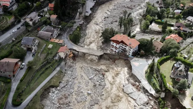
The International Charter Space and Major Disasters exists to bring space technology to the aid of emergency relief teams in the field. Initiated by CNES and ESA in 1999, it today has 17 member space agencies and contributing satellite operators.
Key information
| Mission | Supply optical and radar satellite imagery of disaster areas to emergency responders and decision-makers |
|---|---|
| Domain | Earth observation |
| Start date | Created in 1999, operational since 2000 |
| Partners (in alphabetical order) | ABAE, CNES, CNSA, CONAE, CSA, DLR, ESA, Eumetsat, INPE, ISRO, JAXA, KARI, NOAA, Roscosmos, UAESA, UKSA, USGS |
| Where | Entire Earth |
| Lifetime | Indefinite |
| Status | In operation |
Key figures
- 17 member institutions, 7 data suppliers
- 270 taskable satellites
- 859 disasters already covered
- 134+ countries assisted
Key milestones
- October 2025-April 2026: France’s seventh term as Charter President
- 2025: 25th anniversary of Charter
- 2017: Charter wins William T. Pecora Award
- 2012: Universal access allowing all world nations to become Authorized Charter Users
- November 2000: Charter activated for first time in response to a landslide in Slovenia
- 1 November 2000: Charter enters operational service
- 20 October 2000: Canadian Space Agency (CSA) joins Charter
- September 2000: Inception of International Charter Space and Major Disasters
- July 1999: ESA and CNES propose idea of Charter at UNISPACE III conference in Vienna
Project in brief
At the United Nations’ UNISPACE III conference in Vienna in July 1999, CNES and ESA advocated the idea of a charter through which members would commit to provide free access to their satellite data to countries hit by major man-made or natural disasters, giving birth to the International Charter Space and Major Disasters. The two founding members were soon joined by the Canadian Space Agency (CSA), which signed up in October 2000, and the Charter has since seen its ranks swell with space agencies and international organizations from around the world. It is a unique coalition transcending the usual political and economic divides to respond to crisis situations, open to space agencies and national or international space system operators. Civil defence and security agencies as well as rescue organizations in signatory nations are also naturally in line to be authorized users of the Charter’s services.
In order to provide timely assistance from emergency response teams to affected populations, the Charter’s members are on permanent watch. After authenticating and validating each request to activate it, the Charter tasks member agencies’ satellites to get value-added maps to teams in the field that they can use easily without any need for special expertise in interpreting satellite imagery.
Since coming into effect in November 2000, the Charter has been activated about 1000 times around the world (as of 3 February 2025), with half of these cases in response to flooding events and about 25% to severe weather events (storms, hurricanes/typhoons/cyclones, wildfires in drought conditions, landslides following torrential rain, extreme snowfall, etc.). No continent has been spared, and nearly half of the world’s nations have already requested the Charter’s assistance at some point.
In video
France and CNES’s role in the Charter
France’s space policy is geared towards accomplishing the goals of the Paris Agreement and the Sendai Framework for Disaster Risk Reduction. The French SPOT, Pleiades and Pleiades Neo satellites spearhead the Charter’s resources: in recent years, some 30% of post-disaster damage maps have been generated from Pleiades data.
A key CNES partner, ICube-SERTIT, is a specialist image processing and remote sensing department with a 20-year track record in rapid mapping, generating value-added data products from satellite imagery of disaster areas. Its experts are thus able to convey timely maps of damage, disaster intensity, spontaneous gatherings of people, open roads and so on.
In October 2025, France—via CNES—will begin its seventh six-month term as Charter president. This rotating presidency is assumed by all members and covers operational coordination of Charter activations and coordination of its governance (Board, Executive Secretariat and Communication Group).
Acquired satellite imagery used to compile damage maps will also be made available outside the Charter to the Recovery Observatory, an initiative supporting reconstruction efforts in the aftermath of major disasters by supplying satellite imagery over a period of several months. This approach proven since 2020 by the Committee on Earth Observation Satellites (CEOS) has already been applied for five major disasters: the explosion at the Port of Beirut in 2020, the earthquake in Haiti in 2021, hurricanes Eta and Iota in Central America, and floods in Pakistan in 2022 and Libya in 2023.
More information on the charter website
Contacts
Project Leader and CNES Representative on the Charter’s Executive Secretariat
Emilie Bronner
E-mail: emilie.bronner at cnes.fr
CNES Representative on the Charter Board
Linda Tomasini
E-mail: linda.tomasini at cnes.fr


