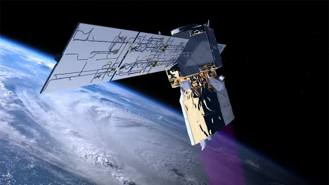
Aeolus was the first satellite capable of observing wind activity in our atmosphere, using laser technology to produce dynamic 3D maps.
Key information
| Mission | Measure winds in Earth’s atmosphere |
|---|---|
| Domain | Earth observation |
| Start date | 23 August 2018 |
| Partners | ESA, LATMOS, LMD, IPSL, Airbus Defence & Space |
| Where | Sun-synchronous polar orbit (400 km) |
| Lifetime | 3 years |
| Status | Completed |
Key figures
- 1.5 m: diameter of telescope
- 0 to 30 km: altitudes studied
- 1,366 kg: satellite mass
- 1 instrument: Aladin
Key milestones
- 28 July 2023: Aeolus re-enters atmosphere
- 20 April 2023: End of Aeolus mission
- 22 August 2018: Launched by Vega from Guiana Space Centre
- 23 May 2017: Testing of Aladin instrument
- 2007: Testing of Aladin demonstrator
- 2003: Satellite design
- 1999: Project selected for ESA’s Living Planet programme
Project in brief
From its 400-km orbit, the European Aeolus satellite—named after the Greek god of wind—was launched in August 2018 by the European Space Agency (ESA). It generated wind profiles from all around the globe up to an altitude of 30 kilometres. The incredibly accurate observations relied on a radically new method that didn’t involve tracking cloud movements or measuring sea surface roughness. Instead, Aeolus used its unique Atmospheric Laser Doppler Instrument (Aladin).
Aladin was a lidar/Doppler instrument with a high-power laser emitting near-ultraviolet light pulses (335 nm). This light was then reflected by molecules, aerosols and cloud particles in the atmosphere, and bounced back to the satellite’s 1.5-metre telescope to be analysed by highly accurate sensors. Such observations are valuable for climatologists, with a view to improving weather forecasts, especially in the southern hemisphere’s intertropical zone where ground-based weather stations are scarce.
Aeolus was selected in 1999 as one of the two flagship missions of ESA’s Living Planet programme. French scientists and laboratories—such as the LATMOS atmospheres, environments and space observations laboratory, the LMD dynamic meteorology laboratory and the Pierre Simon Laplace Institute (IPSL)—contributed their world-renowned expertise in lidar technology to the project. Airbus Defence & Space (formerly EADS Astrium Satellites) built the Aeolus satellite and its Aladin instrument.
CNES’s role
CNES coordinated with ESA to support French research teams involved in the project’s design and development. It also contributed during the mission’s calibration/validation and operational stages (including operational meteorological model integration) starting in 2018.
CNES contacts
Head of Atmospheric Physics & Meteorology
Adrien Deschamps
E-mail: adrien.deschamps at cnes.fr


