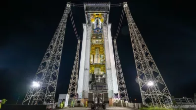
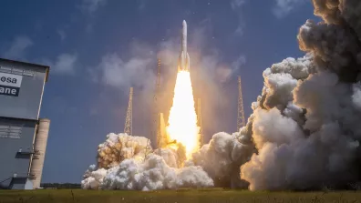
Le 1er décembre 2025 à 14h21 heure locale (18h21 heure de Paris), Vega-C, opéré par Arianespace, a réussi sa mission depuis le Centre spatial guyanais (CSG), port spatial de l’Europe. Le lanceur léger européen a placé sur orbite héliosynchrone Kompsat-7 (KOrea Multi-Purpose SATellite-7) pour le compte de l'Institut coréen de recherche aérospatiale (KARI). Ce lancement est le sixième de 2025 depuis le CSG, le troisième de l’année pour Vega-C, le sixième de la famille Vega-C et plus globalement le vingt-huitième de la famille des lanceurs Vega depuis le premier décollage au CSG en 2012.
La mission d’observation de la Terre de Kompsat-7 vise à fournir des images satellitaires de haute résolution pour répondre aux besoins gouvernementaux et institutionnels de la Corée du Sud. Développé par le KARI sur son site de Daejeon, le satellite d’environ 2 000 kg au lancement est équipé de la caméra spatiale haute résolution AEISS-HR (Advanced Earth Imaging Sensor System with High Resolution). Elle possède une résolution de 30 cm en mode panchromatique, de 1,2 m en mode couleur et de 4 m en mode infrarouge. La durée de vie minimale du satellite est de cinq ans.
(Re)voir le lancement
Consulter le communiqué en .pdf
Lancement réussi de la 6e mission de Vega-C
pdf - 270.22 KB