Since its launch 28 April 2006, Calipso has collected a whole series of measurements of the structure of Earth’s atmosphere never acquired before. Equipped with its CALIOP lidar—a sort of optical radar capable of analysing the vertical structure of clouds and aerosols in fine detail—Infrared Imager Radiometer (IIR) and Wide-Field Camera (WFC), Calipso is designed to identify the impact of clouds and aerosols on climate change.
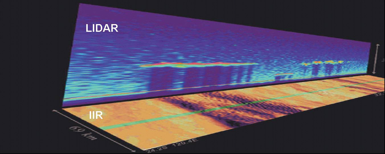
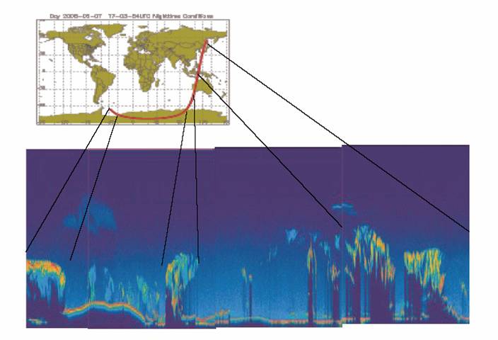
For Charles R. Trepte, the U.S. Principal Investigator for Calipso, what makes this mission special is its ability to acquire complementary measurements: “Up until now, most of the information we learned about clouds and aerosols from satellites has been related to their horizontal coverage. We didn't know much about their vertical distribution—how thick are the layers, how many layers and do they overlap.”
Calipso data were made available to scientists worldwide on 8 December 2006, less than 6 months after the satellite gathered its 1st measurements.
Jacques Pelon, Principal Investigator on the French side of the mission, hails this major first: “Research scientists now have a data set covering almost 6 months to work on, which is much a longer period than any similar missions have achieved.”
Successful partnership
Less than 1 year after launch, the joint CNES/NASA mission is already proving most prolific.
Charles R. Trepte stresses the central role played by CNES teams in this success: “The mission is very complex and both teams have worked hard and closely with each other to overcome many technical challenges. Presently, the spacecraft and instruments are working well and scientists around the world have begun using the high-quality data set in scientific studies.”
Calipso data are available via NASA’s Langley Research Center or via the French ICARE data centre dedicated to the study of interactions between clouds, aerosols, radiation and the water cycle.
More about
Previous news
Calipso flying high
11 December 2006
Calipso climbs aboard the train
6 June 2006
Calipso launch preparations
27 April 2006
Calipso ready to go
20 April 2006
Calipso to launch end October
20 September 2005
Calipso satellite arrives in the United States
3rd June 2005
11 December 2006
Calipso climbs aboard the train
6 June 2006
Calipso launch preparations
27 April 2006
Calipso ready to go
20 April 2006
Calipso to launch end October
20 September 2005
Calipso satellite arrives in the United States
3rd June 2005