23 February 2006
20 years observing Earth
20 years ago to the day, on 22 February 1986, the Spot 1 Earth observation satellite soared skyward. Only 3 days later, it sent back its 1st image—a truly remarkable performance.
Spot 1 represented a leap ahead in Earth observation, offering a resolution of 10 m that enabled it to see smaller features than ever before, while clearly setting it apart from the U.S. Landsat satellites.
It also provided the capability to map terrain relief with an accuracy of 10 m.
Initially designed for a 3-year mission, Spot 1 continued operating until it was deorbited in 2003. Circling Earth for 17 years, it took more than 2.7 million pictures of our planet.
In that time, Spot 1 was joined by a series of sister satellites, the last being Spot 5, launched in 2002.
Today, 3 satellites are still in service, keeping a close eye on Earth’s surfaces.
In the final reckoning, the 5 Spot satellites together have acquired some 10 million images.
In that time, Spot 1 was joined by a series of sister satellites, the last being Spot 5, launched in 2002.
Today, 3 satellites are still in service, keeping a close eye on Earth’s surfaces.
In the final reckoning, the 5 Spot satellites together have acquired some 10 million images.
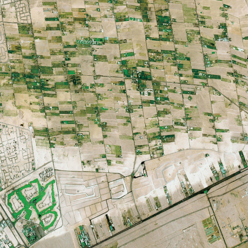
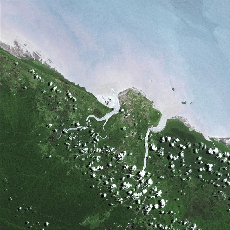
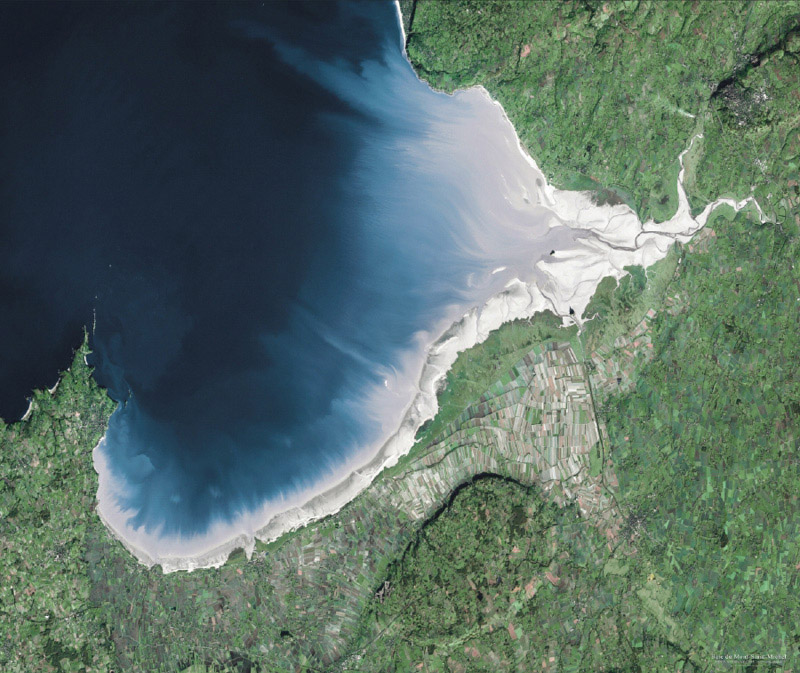
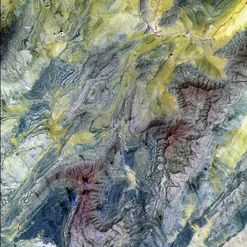
Spot imagery has found applications in many areas, delivering data that are vital for mapping and a precious aid for natural resource management and land planning.
A superb achievement for CNES
The Spot series is a superb feat of engineering by CNES.
The technologies employed on Spot 1 have proven reliable and flexible.
Successive enhancements have culminated in Spot 5, the civil Earth observation satellite most used in the world today, with a resolution of 2.5 m.
The technologies employed on Spot 1 have proven reliable and flexible.
Successive enhancements have culminated in Spot 5, the civil Earth observation satellite most used in the world today, with a resolution of 2.5 m.

The Spot satellite bus was re-used for ERS-1 and ERS-2, on Esa’s Envisat satellite and on the MetOp weather satellites.
The Spot series was also an essential building block for France’s Helios military observation systems.
Through Spot, CNES and its industry partners have established themselves in all areas of satellite-based remote sensing.
In so doing, CNES has acquired a broad spectrum of skills in mission design and implementation, covering development of satellites and instruments, image reception and processing, orbit control and payload tasking.
In so doing, CNES has acquired a broad spectrum of skills in mission design and implementation, covering development of satellites and instruments, image reception and processing, orbit control and payload tasking.
With Spot 5, the Spot programme still has plenty of mileage in it.
But CNES is already gearing up for the future.
In 2008, Pleaides will come on stream, enhancing and complementing the Spot portfolio with higher-resolution optical imagery to further extend the range of satellite data products for civil and military users.